Phillipsdale Landing
The Phillipsdale Landing sondes have been deployed for the season since May 9th, 2023 utilizing a new setup allowing staff access to the equipment from the boat instead of standing on the dock. During the month of September, sondes were changed out for routine maintenance on September 14th and 27th.
Surface DO remained above the hypoxia threshold all month. The bottom waters were hypoxic periodically throughout the month, with the longest sustained hypoxic periods (10 hours) occurring in the early morning of September 10th and again on the afternoon of the 10th and the morning of the 11th. DO averaged 8.2 mg/L at the surface with a minimum of 3.2 mg/L, while bottom waters averaged 4.4 mg/L with a minimum of 0.0 mg/L.
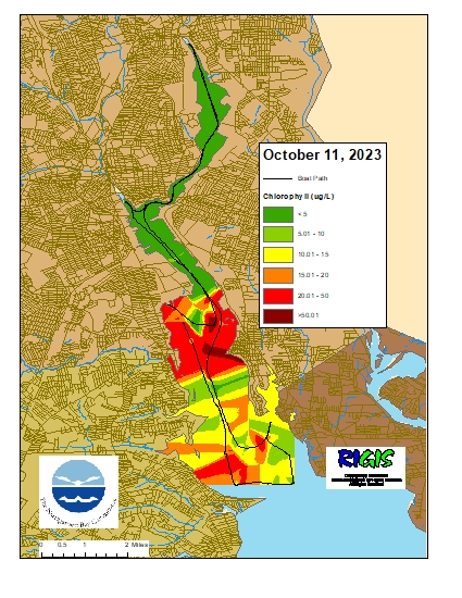
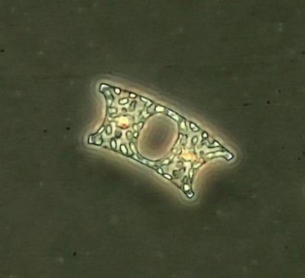
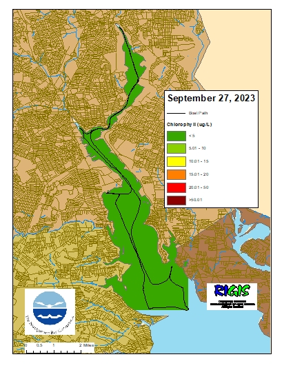
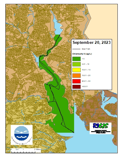
Chlorophyll readings were frequently elevated during the first half of the month, suggestive of phytoplankton blooms, but went back down in the second half of the month. The surface and bottom readings averaged 12.0 µg/L and 6.1 µg/L, respectively.
Bullock Reach
The Bullock Reach buoy was deployed June 1st for the 2023 season. During the month of September, sondes were changed out for routine maintenance on September 7th and 21st.
Surface DO remained above the hypoxia threshold all month. There were a few brief periods of hypoxic conditions in the middle waters, with the longest duration at 1.5 hours on September 24th. The bottom waters were hypoxic periodically throughout the month, with the longest sustained period of hypoxic conditions at 26 hours between the 13th and 14th. Surface, middle, and bottom DO averaged 7.3 mg/L, 5.4 mg/L, and 4.0 mg/L, respectively.
Chlorophyll readings ranged from low to elevated, with evidence of moderate phytoplankton blooms occurring throughout the month. Readings averaged 11.7 µg/L at the surface, 9.6 µg/L at mid-depth, and 3.5 µg/L at the bottom.